

Image Repository
DMR Spring 2020 Project Imagery
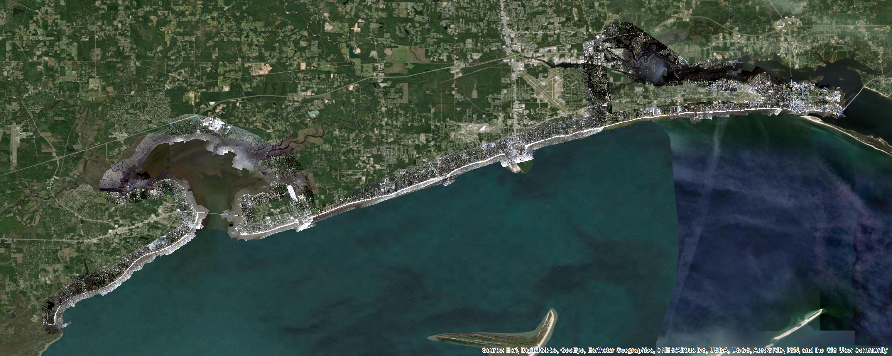
DMR Coastal Imagery 16-Bit RGBN ArcMap Layer Package (67 GB)
This layer package contains 4-Band Red/Green/Blue/Near-Infrared (RGBN) 16-bit raster mosaics, in eight processed chunks. They are stacked in the proper order for display and have various gamma offsets and imagery stretches applied for improved viewing.Rasters were processed in Agisoft Metashape, with "Medium" alignment, "Medium" density point cloud, and "Low" quality mesh surface. Additional adjustments were made using ESRI ArcMap's Georeferencing Tool. Most raster areas should be within a few feet or better in accuracy. Note that some visual inconsistencies may appear due to imagery overlaps not allowing for perfect surface reconstruction, so some areas may exhibit "wobble", particularly towards the edges or on complex shapes.
DMR Coastal Imagery 8-Bit RGB ArcMap Layer Package (19 GB)
This layer package contains 3-Band Red/Green/Blue (RGB) 8-bit raster mosaics, in eight processed chunks. These have also been stacked in the proper order for viewing. The same gamma offsets and stretch values as the 16-bit layer package above were used for this dataset, but have been pre-applied to the imagery, so no additional stretches are needed unless desired by the user.DMR Coastal Imagery 8-Bit RGB GeoTIFF (12 GB)
This dataset contains an 8-bit GeoTIFF scaled from the 16-bit mosaic chunks. These were initially scaled using Geospatial Data Abstraction Library software (GDAL), then color balanced using various stretches and gamma corrections in ArcMap.DMR Coastal Imagery Five-Class Geometric GeoTIFF (1.6 GB)
This file contains a classified GeoTIFF based on the Near-Infrared (NIR) band of the imagery. A five-class geometric classification method was used in ArcMap, and delineates the coastal areas well in most instances. Due to lighting changes from both cloud cover and differing flight dates and times, a single breakpoint classification was unsuitable.Note that the presence of cloud cover will affect some areas, rendering them as "land" when they are not.
To preserve the color ramp and proper display, ensure no color stretch is enabled in ArcMap.
DMR Coastal Imagery Times and Tidal Levels Shapefiles
This shapefile archive contains approximate boundaries for each used portion of the raster mosaics, along with associated times raw imagery was collected. These times were used to index to tidal levels obtained from NOAA's Tides and Currents website, using two stations: Bay Waveland Yacht Club, and Pascagoula NOAA Lab. The CSVs obtained from the website have also been included in the archive.Tidal levels may be represented as either a single value, or a range of values for larger areas.